World’s most powerful Earth observation satellite marks historic Indo-US collaboration; science phase begins in 90 days
Bengaluru, NFAPost: In a defining moment for space collaboration and Earth sciences, the Indian Space Research Organisation (ISRO) on Wednesday successfully launched the NASA-ISRO Synthetic Aperture Radar (NISAR) satellite, placing it into a precise sun-synchronous orbit aboard the GSLV-F16 rocket. Touted as the most advanced Earth observation mission ever undertaken, NISAR is now poised to revolutionise global disaster prediction, environmental monitoring, and climate science.
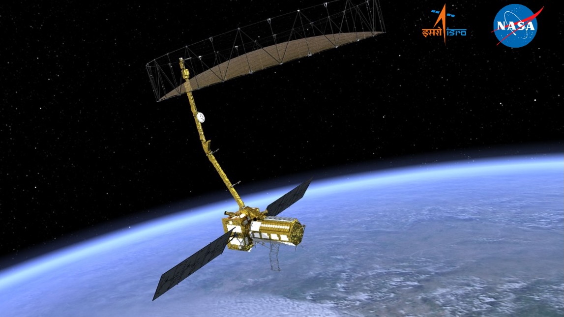
Launched at 5:40 PM IST from the Satish Dhawan Space Centre in Sriharikota, NISAR represents over a decade of collaboration between ISRO and NASA’s Jet Propulsion Laboratory (JPL). The 2.8-tonne satellite carries dual-frequency radar — L-band (NASA) and S-band (ISRO) — mounted on a striking 12-metre-wide deployable reflector antenna.
A New Era in Earth Observation
“NISAR is an engineering marvel and a symbol of what India and the United States can achieve together,” said Casey Swails, NASA’s Deputy Associate Administrator, who was present at the launch site. V. Narayanan, ISRO Chairperson, called it the result of “meticulous, joint effort,” noting the satellite’s data will be “highly useful for the global scientific community.”
The mission, which marks the first time dual Synthetic Aperture Radars (SARs) have flown together, will deliver high-resolution data every 12 days from 747 km above Earth, enabling unprecedented tracking of:
- Land deformation due to earthquakes, landslides, volcanic activity, and subsidence
- Movement and thickness changes in ice sheets, sea ice, and glaciers
- Changes in wetlands, agricultural lands, and forest biomass
- Subtle surface movements linked to aquifers, hydrocarbon reserves, and tectonic shifts
“This is going to be a game-changer for managing disasters such as cyclones and floods,” said Dr. Jitendra Singh, Union Minister for Science & Technology and Space, who joined the event from Delhi. “With its ability to see through cloud, fog, and ice, NISAR will also benefit sectors like aviation and shipping.”
How NISAR Works
At its heart, NISAR uses a novel SweepSAR technology, allowing it to generate images with resolutions of 5 to 100 metres over swaths of up to 240 km. Unlike optical satellites, its radar eyes can see day or night, through weather, and across seasons.
The satellite will take about 10 days to complete deployment of its 9-metre boom and 12-metre reflector, after which ISRO and NASA teams will begin system checks. Full-scale science operations will commence after a 90-day commissioning period, beginning around September–October 2025.
The mission has a planned life of five years, during which its data will be freely and openly available to researchers and decision-makers worldwide. ISRO will oversee satellite command and control, while NASA will provide the radar operations plan and orbital manoeuvre strategy. Ground stations from both space agencies will support data acquisition and distribution.
Shared Vision, Shared Payload
The ISRO-NASA workshare illustrates a balance of technological prowess. While ISRO provided the spacecraft bus (based on its I-3K platform), S-band SAR, and launch via GSLV Mk-II, NASA contributed the L-band SAR, high-speed downlink systems, the Solid-State Recorder, GPS, and the mechanical system for deploying the radar reflector.
The radar payloads were independently developed, tested at their respective labs (ISRO’s SAC and NASA’s JPL), and integrated in the US before final assembly in Bengaluru’s URSC.
From Launch to Science
The mission will unfold in four key phases:
- Launch Phase – Achieved with today’s flawless GSLV-F16 launch.
- Deployment Phase – Over the next two weeks, the satellite’s reflector and boom will unfurl in orbit.
- Commissioning Phase – 90 days of calibrations and system validation.
- Science Phase – Long-term observations and global data delivery begin, supporting scientific and operational goals across both nations.
A Global Mission with Indian Heartbeat
While NISAR is the result of joint development, much of its final integration and launch was led by India — a testament to the country’s rising capability in complex space missions. The satellite’s strategic value in understanding the Earth’s changing systems cannot be overstated.
As natural disasters increase in frequency and intensity due to climate change, NISAR is expected to play a vital role in saving lives and protecting livelihoods.
In the words of ISRO’s chief Narayanan, “This is not just a satellite — it’s humanity’s eye on a fragile, changing planet.”